
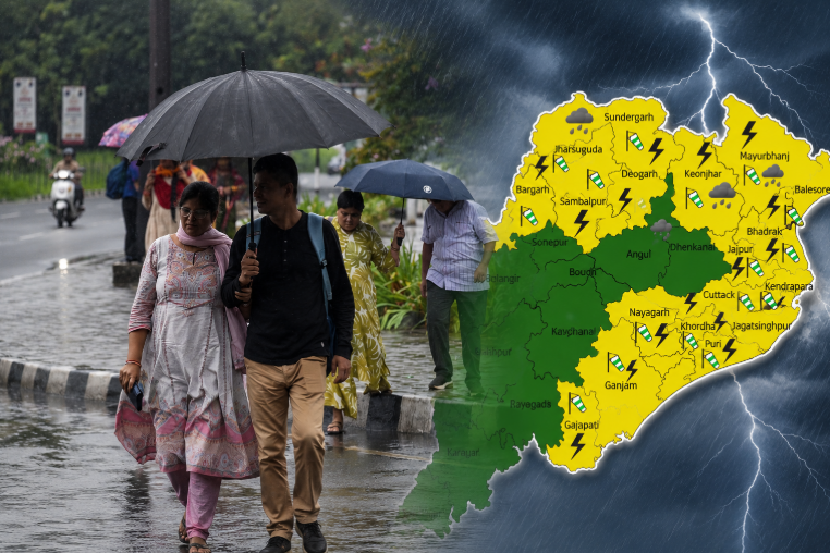
Bhubaneswar: A fresh low-pressure area is likely to form over the Bay of Bengal, with Odisha expected to witness heavy rainfall activity for the next seven days, Regional Centre of Indian Meteorological Department said Saturday.
A cyclonic circulation has developed over West Bengal and adjoining Bangladesh and is currently active at an altitude of 4.5 km to 5.8 km above mean sea level. Due to favourable atmospheric conditions, the system is likely to intensify into a low-pressure area, officials said.
The weather system is expected to bring thunderstorms and rain across Odisha over the next week. Rainfall intensity is likely to increase from July 13, Regional Meteorological Centre director Dr Manorama Mohanty said.
Several districts received rainfall Friday, while light to moderate rain is expected in many parts of the state Saturday. The weather department has issued a yellow warning for parts of Sundaragada, Kendujhar and Mayurbhanj districts, where thunderstorms, lightning and gusty winds are likely.
In the past 24 hours, rainfall was recorded at 13 places across Odisha, with Gurundia in Sundaragada district receiving the highest rainfall of 71 mm.
Between June 1 and July 10, Odisha recorded 341 mm of rainfall, which is 12% above the normal average for the period, according to the weather department.
During the ongoing monsoon season, six districts have recorded excess rainfall, five districts have received above-normal rainfall and 15 districts have witnessed normal rainfall. However, Sundaragada, Nabarangpur, Deogada and Kalahandi districts have recorded deficient rainfall so far.