Odisha News, Odisha Latest news, Odisha Daily - OrissaPOST
  • Home
  • Trending
  • State
  • Metro
  • National
  • International
  • Business
  • Feature
  • Entertainment
  • Sports
  • More..
    • Odisha Special
    • Editorial
    • Opinion
    • Careers
    • Sci-Tech
    • Timeout
    • Horoscope
    • Today’s Pic
  • Video
  • Epaper
  • News in Odia
No Result
View All Result
OrissaPOST - Odisha Latest news, English Daily -
No Result
View All Result

How satellites revolutionized the way we see and protect the natural world

PTI
Updated: July 24th, 2022, 07:20 IST
in Sci-Tech
0
Satelite

Pic Credit- OP Post (Representational image)

Share on FacebookShare on TwitterShare on WhatsAppShare on Linkedin

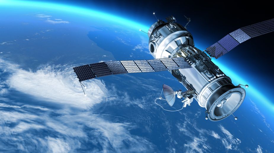
Melbourne: Fifty years ago, US scientists launched a satellite that dramatically changed how we see the world.

It captured images of Earth’s surface in minute detail, showing how wildfires burned landscapes, how farms erased forests and many other ways humans were changing the face of the planet.

Also Read

International Space Station ISS Wiki

NASA orders astronauts to take shelter after new leak aboard the International Space Station

5 days ago
Narendra Modi

Hyperscale data centre specialist AirTrunk to invest Rs 3 lakh crore in India: PM Modi

5 days ago

The first satellite in the Landsat series launched July 23, 1972. Eight others followed, providing the same views so changes could be tracked over time, but with increasingly powerful instruments. Landsat 8 and Landsat 9 are orbiting the planet today, and NASA and the US Geological Survey are planning a new Landsat mission.

The images and data from these satellites are used to track deforestation and changing landscapes around the world, locate urban heat islands, and understand the impact of new river dams, among many other projects. Often, the results help communities respond to risks that may not be obvious from the ground.

Here are three examples of Landsat in action, from The Conversation’s archive.

Tracking changes in the Amazon

When work began on the Belo Monte Dam project in the Brazilian Amazon in 2015, Indigenous tribes living along the Big Bend of the Xingu River started noticing changes in the river’s flow. The water they relied on for food and transportation was disappearing.

Upstream, a new channel would eventually divert as much as 80% of the water to the hydroelectric dam, bypassing the bend.

The consortium that runs the dam argued that there was no scientific proof that the change in water flow harmed fish.

But there is clear proof of the Belo Monte Dam project’s impact – from above, write Pritam Das, Faisal Hossain, Hörður Helgason and Shahzaib Khan at the University of Washington. Using satellite data from the Landsat program, the team showed how the dam dramatically altered the hydrology of the river.

“As scientists who work with remote sensing, we believe satellite observations can empower populations around the world who face threats to their resources,” Das and his colleagues write.

It’s hot in the city – and even hotter in some neighbourhoods

Landsat’s instruments can also measure surface temperatures, allowing scientists to map heat risk street by street within cities as global temperatures rise.

“Cities are generally hotter than surrounding rural areas, but even within cities, some residential neighbourhoods get dangerously warmer than others just a few miles away,” writes Daniel P. Johnson, who uses satellites to study the urban heat island effect at Indiana University.

Neighbourhoods with more pavement and buildings and fewer trees can be 10 degrees Fahrenheit or warmer than leafier neighbourhoods, Johnson writes. He found that the hottest neighbourhoods tend to be low-income, have majority Black or Hispanic residents and had been subjected to redlining, the discriminatory practice once used to deny loans in racial and ethnic minority communities.

“Within these ‘micro-urban heat islands,’ communities can experience heatwave conditions well before officials declare a heat emergency,” Johnson writes.

Knowing which neighbourhoods face the highest risks allows cities to organize cooling centres and other programs to help residents manage the heat.

The making of ghost forests

Satellites that scan the same areas year after year can be crucial for spotting changes in hard-to-reach regions. They can monitor snow and ice cover, and, along the U.S. Atlantic coast, dying wetland forests.

These eerie landscapes of the dead, often bleached-white tree trunks have earned the nickname “ghost forests.”

Emily Ury, an ecologist now at the University of Waterloo in Ontario, used Landsat data to spot wetland changes. She then zoomed in with high-resolution images from Google Earth – which includes Landsat images – to confirm that they were ghost forests.

“The results were shocking. We found that more than 10% of forested wetland within the Alligator River National Wildlife Refuge [in North Carolina] was lost over the past 35 years. This is federally protected land, with no other human activity that could be killing off the forest,” Ury writes.

As the planet warms and sea levels rise, more salt water is reaching these areas, increasing the amount of salt in the soil of coastal woodlands from Maine to Florida. “Rapid sea level rise seems to be outpacing the ability of these forests to adapt to wetter, saltier conditions,” Ury writes.

Many more stories can be found in Landsat’s images, such as an overview of the war’s effects on Ukraine’s wheat crop, and how algae blooms have spread in Florida’s Lake Okeechobee. Countless projects are using Landsat data to track global change and possibly find solutions to problems, from deforestation in the Amazon to the fires that have put Alaska on pace for another historic fire season.

By Stacy Morford, Environment + Climate Editor

(The Conversation)

Tags: LandsatSatellite
ShareTweetSendShare
Suggest A Correction

Enter your email to get our daily news in your inbox.


OrissaPOST epaper Sunday POST OrissaPOST epaper

Click Here: Plastic Free Odisha

#MyPaperBagChallenge

Parbati Mohanty

December 12, 2019
#MyPaperBagChallenge

Ankita Balabantray

December 12, 2019
#MyPaperBagChallenge

Pragyan Priyambada

December 12, 2019
#MyPaperBagChallenge

Adweeti Bhattacharya

December 12, 2019
?????????????????????????????????????????????????????????????????????????????????????????????????????????????????????????????????
#MyPaperBagChallenge

Dibya Ranjan Das

December 12, 2019
#MyPaperBagChallenge

Ramakanta Sahoo

December 12, 2019
#MyPaperBagChallenge

Archana Parida

December 12, 2019
#MyPaperBagChallenge

Bijswajit Pradhan

December 12, 2019
#MyPaperBagChallenge

Ramakanta Sahoo

December 12, 2019
#MyPaperBagChallenge

Pratyasharani Ghibela

December 12, 2019
#MyPaperBagChallenge

Subhajyoti Mohanty

December 12, 2019
#MyPaperBagChallenge

Spinoj Pattnaik

December 12, 2019
#MyPaperBagChallenge

Jhili Jena

December 12, 2019
#MyPaperBagChallenge

Akshaya Kumar Dash

December 12, 2019
#MyPaperBagChallenge

Sibarama Khotei

December 12, 2019
#MyPaperBagChallenge

Aman Kumar Barisal

December 12, 2019
#MyPaperBagChallenge

Shreyanshu Bal

December 12, 2019
#MyPaperBagChallenge

Rajashree Manasa Mohanty

December 12, 2019
#MyPaperBagChallenge

Pratik Kumar Ghibela

December 12, 2019
#MyPaperBagChallenge

Aishwarya Ranjan Mohanty

December 12, 2019
#MyPaperBagChallenge

Surya Sidhant Rath

December 12, 2019
#MyPaperBagChallenge

Debasis Mohanty

December 12, 2019
#MyPaperBagChallenge

Anasuya Sahoo

December 12, 2019
#MyPaperBagChallenge

Swarit Praharaj

December 12, 2019
#MyPaperBagChallenge

Anup Mahapatra

December 12, 2019
#MyPaperBagChallenge

Tabish Maaz

December 12, 2019
#MyPaperBagChallenge

Pitabas Tripathy

December 12, 2019
#MyPaperBagChallenge

Rajashree Pravati Mohanty

December 12, 2019
#MyPaperBagChallenge

Jyotshna Mayee Pattnaik

December 12, 2019
#MyPaperBagChallenge

Archit Mohapatra

December 12, 2019

Archives

Editorial

Two-Man Drama

Netanyahu to meet Trump
June 10, 2026

The renewed exchange of missiles between Israel and Iran through June 8-9 is ample evidence of instability continuing in the...

Read moreDetails

Deifying Dollar

Donald Trump
June 9, 2026

US President Donald Trump’s craving for long-lasting fame is well known. It assumed scandalous proportions while he was pursuing the...

Read moreDetails

Ethanol Agenda

June 8, 2026

On World Environment Day, 5 June, India launched E85, that is, petrol blended with 85 per cent ethanol at 48...

Read moreDetails

Longevity Vs Legacy

AAKAR PATEL
June 7, 2026

By Aakar Patel Friend Ram Madhav has written a fine piece on Prime Minister Narendra Modi reaching an important milestone....

Read moreDetails
  • Home
  • State
  • Metro
  • National
  • International
  • Business
  • Editorial
  • Opinion
  • Sports
  • About Us
  • Advertise
  • Contact Us
  • Jobs
Developed By Ratna Technology

© 2025 All rights Reserved by OrissaPOST

  • News in Odia
  • Orissa POST Epaper
  • Video
  • Home
  • Trending
  • Metro
  • State
  • Odisha Special
  • National
  • International
  • Sports
  • Business
  • Editorial
  • Entertainment
  • Horoscope
  • Careers
  • Feature
  • Today’s Pic
  • Opinion
  • Sci-Tech
  • About Us
  • Contact Us
  • Jobs

© 2025 All rights Reserved by OrissaPOST

    • News in Odia
    • Orissa POST Epaper
    • Video
    • Home
    • Trending
    • Metro
    • State
    • Odisha Special
    • National
    • International
    • Sports
    • Business
    • Editorial
    • Entertainment
    • Horoscope
    • Careers
    • Feature
    • Today’s Pic
    • Opinion
    • Sci-Tech
    • About Us
    • Contact Us
    • Jobs

    © 2025 All rights Reserved by OrissaPOST