
New Delhi: As the severe cyclonic storm ‘Asani’ moved towards Andhra Pradesh, the India Meteorological Department (IMD) issued a red alert Tuesday for the state’s coastal areas. The IMD said that there will be a storm surge, heavy rainfall in several areas, gale and squally winds, and local area flooding. However, ‘Asani’ is not likely to make a landfall.
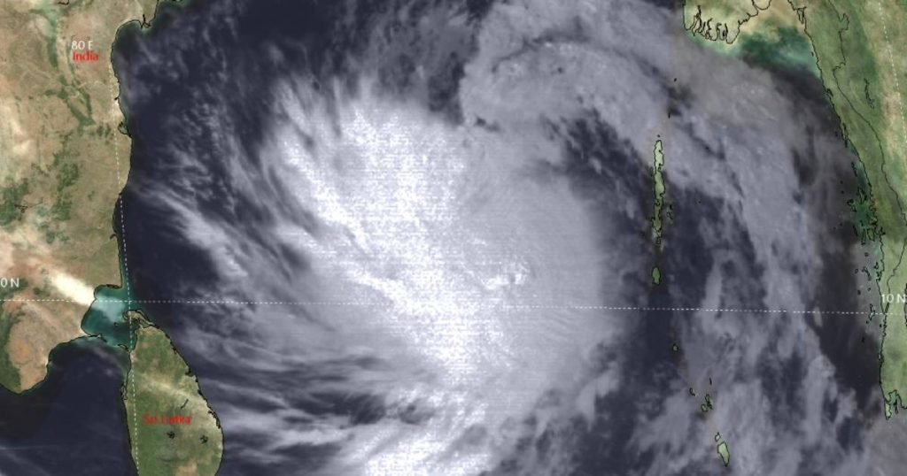
The IMD informed that ‘Cyclone Asani’ lies over west-central and adjoining southwest Bay of Bengal. It will move west-northwestwards with a speed of 23 kmph through the day. It currently lay centred at 2.30pm over westcentral Bay of Bengal at about 210 kms south-southeast of Kakinada (Andhra Pradesh), 310 kms south-southwest of Visakhapatnam (Andhra Pradesh), 590 kms southwest of Gopalpur (Odisha) and 640 kms southwest of Puri (Odisha).
“It is very likely to move nearly northwestwards and reach west-central Bay of Bengal, close to Kakinada-Vishakhapatnam coasts by Wednesday morning. Thereafter, it is very likely to re-curve slowly north-northeastwards and move along Andhra Pradesh coast between Kakinada and Vishakhapatnam and then emerge into northwest Bay of Bengal off north Andhra Pradesh and Odisha coasts,” the IMD bulletin said.
“It is likely to weaken gradually into a cyclonic storm by Wednesday morning itself and into a depression by May 12 morning,” the bulletin added.
The IMD has predicted a storm surge of height about 0.5 m above astronomical tide that is likely to inundate low lying areas of Krishna, East and West Godavari and Vishakhapatnam districts of Andhra Pradesh.
Fishermen have been warned of total suspension of fishing operations over west-central Bay of Bengal Tuesday and Wednesday while over northwest Bay of Bengal, the warning will continue till May 12.
The IMD has also warned of regulation of offshore operations till May 12.
Even as light to moderate rainfall is predicted at many places with heavy to very heavy rainfall at isolated places continued over coastal Andhra Pradesh and rainfall at a few places with heavy rainfall at isolated places over coastal Odisha from Tuesday night itself, from Wednesday, similar light to moderate rainfall is again predicted at most places with heavy to very heavy rainfall at a few places with isolated extremely heavy rainfall likely over coastal Andhra Pradesh and heavy rainfall at isolated places likely over coastal Odisha and adjoining coastal West Bengal.
May 12, the IMD said, light to moderate rainfall is likely at a few places with heavy rainfall at isolated places likely over coastal areas of Odisha and West Bengal.
Gale wind speed reaching 100-110 kmph, gusting to 120 kmph, is prevailing around the system centre over west-central Bay of Bengal. It would gradually decrease becoming 85-95 kmph gusting to 105 kmph over west-central and adjoining northwest Bay of Bengal from midnight tonight and become 75-85 kmph gusting to 95 kmph from Wednesday morning over the same region.
Further, it would decrease to 55-65 kmph, gusting to 75 kmph over northwest and adjoining west-central Bay of Bengal from morning of May 12.