
Bhubaneswar: A new low pressure area is likely to be formed over the Central Bay of Bengal by May 19. South-west Monsoon is likely to advance into South Andaman Sea, Nicobar Islands and the adjoining Southeast Bay of Bengal during next 24 hours, predicted the regional centre of India Meteorological Department (IMD) here Sunday.
In its mid-day bulletin, the IMD centre said, “A north-south trough runs from Bihar to south Tamilnadu across north Chhattisgarh, Vidarbha, Telangana and interior Karnataka at 1.5 km above mean sea level. The east-west trough from Bihar to Central Assam and Meghalaya across Sub-Himalayan West Bengal at 0.9 km above mean sea level has become less marked.”
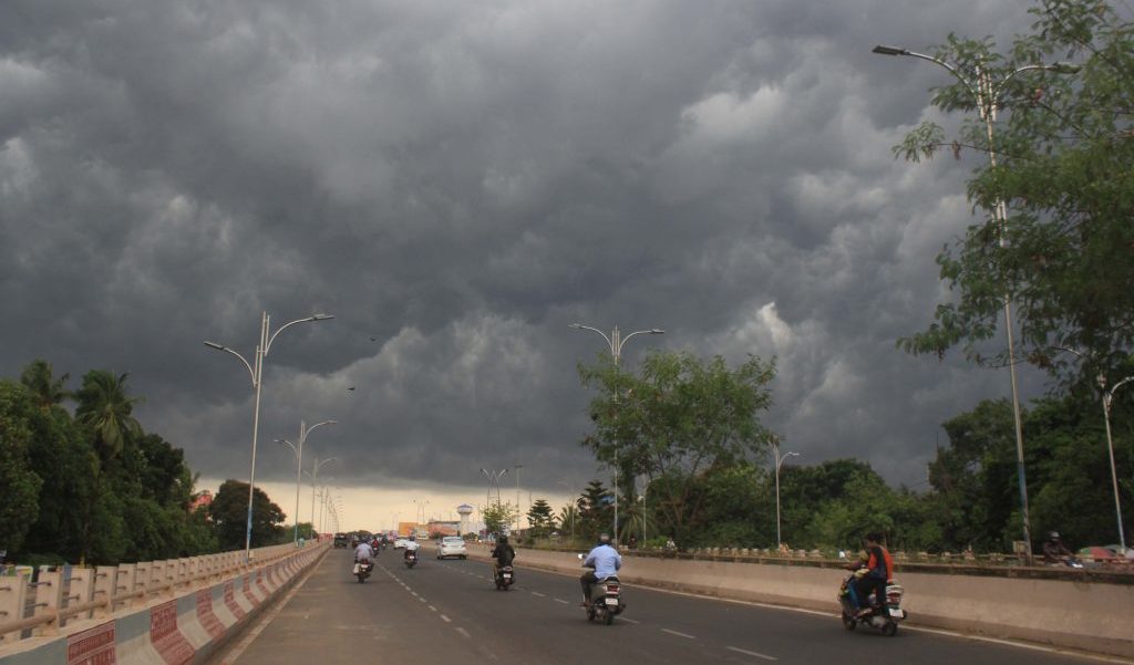
Light to moderate rain/thundershower has occurred at one or two places over the districts of Koraput, Kandhamal, Kalahandi and Nabarangpur of South Interior Odisha and dry weather prevailed over the rest districts of Odisha, the IMD bulletin stated.
Maximum (day) temperatures observed appreciable rise at one or two places over Interior Odisha and South Coastal Odisha and no major change at elsewhere over the Odisha. They were above normal at one or two places over Odisha, below normal at a few places over Coastal Odisha and normal at elsewhere over Odisha.
The highest maximum (day) temperature of 43.2oC was recorded at Titilagarh and the lowest minimum (night) temperature of 24.2oC was recorded at Kendrapara in the plains of Odisha.
Weather forecast and warning for next three days:
Sunday (valid up to 0830 hrs IST of 16.05.2022)
Light to moderate rain or thunderstorm is very likely to occur at a few places over the districts of Sundargarh, Deogarh, Keonjhar, Mayurbhanj, Angul, Dhenkanal, Koraput, Malkangiri, Nabarangpur, and at one or two places over the rest districts of Odisha.
Yellow Warning (Be updated)
Thunderstorm with lightning and gusty surface wind speed reaching 30kmph to 40kmph is very likely to occur at one or two places over the districts of Keonjhar, Mayurbhanj, Angul, Dhenkanal, Koraput, Malkangiri, Nabarangpur and thunderstorm with lightning is very likely to occur at one or two places over the districts of Sundargarh, Deogarh, Bolangir, Kalahandi, Kandhamal, Boudh, Jajpur, Bhadrak and Balasore.
Monday (valid from 0830 hrs IST of 16.05.2022 up to 0830 hrs IST of 17.05.2022)
Light to moderate rain or thunderstorm is very likely to occur at a few places over the districts of Malkangiri, Koraput, Nabarangpur, Kalahandi, Kandhamal, Rayagada, Sundargarh, Deogarh, Keonjhar, Mayurbhanj, Angul, Dhenkanal, Jajpur, Bhadrak and Balasore and at one or two places over the rest districts of Odisha.
Yellow Warning (Be updated)
Thunderstorm with lightning and gusty surface wind speed reaching 40kmph to 50kmph is very likely to occur at one or two places over the districts of Keonjhar, Mayurbhanj, Deogarh, Angul, Dhenkanal, Jajpur, Bhadrak, Balasore and Cuttack and thunderstorm with lightning is very likely to occur at one or two places over the districts of Malkangiri, Koraput, Nabarangpur, Kalahandi, Kandhamal, Rayagada and Sundargarh.
Tuesday (valid from 0830 hrs IST of 17.05.2022 up to 0830 hrs IST of 18.05.2022)
Light to moderate rain or thunderstorm is very likely to occur at a few places over the districts of Interior Odisha and at one or two places over the districts of Coastal Odisha.
Yellow Warning (Be updated)
Thunderstorm with lightning and gusty surface wind speed reaching 30kmph to 40kmph is very likely to occur at one or two places over the districts of Jharsuguda, Sambalpur, Deogarh, Angul, Dhenkanal, Cuttack, Keonjhar, Mayurbhanj, Jajpur, Bhadrak, Balasore and thunderstorm with lightning is very likely to occur at one or two places over the districts of Malkangiri, Koraput, Rayagada, Gajapati, Ganjam, Kandhamal, Nayagarh, Khurda and Puri.
PNN