
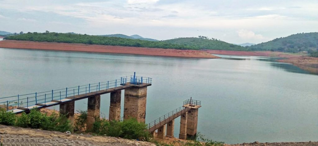
Nandapur: Deficient rainfall in the upper catchment areas has caused water levels to plunge at Jolaput reservoir in Koraput district.
The drop has triggered widespread concern over impending shortages for power generation, Kharif crop cultivation, and local drinking water supplies.
While heavy monsoon rain has triggered flood-like situations in various parts of coastal Odisha, the upper catchment of Machhkund River, also known as Sileru, in Andhra Pradesh’s Alluri Sitharama Raju district has received 46 per cent less rainfall than last year as of August 11.
According to Jolaput reservoir authorities, the water level stood at 2,740.70 ft August 11, 2025. On the same date this year, it was 2,721.70 ft, which is 19 ft lower than the previous year.
Experts said rainfall deficiency, if it continues, could affect power generation at Machhkund hydroelectric project and downstream projects, including Upper Sileru, Lower Sileru, Kalimela and Donkarayi.
It could also affect tourism, farmers, fishermen, drinking water supplies and the environment in the region.
Sileru River in Andhra Pradesh originates in the Mudugal hills of the Eastern Ghats in Andhra Pradesh’s Alluri Sitharama Raju and Visakhapatnam districts.
Jolaput reservoir was built to store water from the Sileru River, or Machhkund River.
The reservoir covers about 1,963 sq km across 10 gram panchayats in Nandapur block and normally stores about 971 million cubic metres (34.27 billion cubic ft) of water between July and September.
During this monsoon period, the reservoir level generally rises to between 2,745 and 2,748 ft. This year, however, below-normal rainfall has affected the reservoir’s inflow.
While some parts of India have experienced heavy rain and flooding, several areas have received deficient rainfall.
In the catchment area of the reservoir in Andhra Pradesh’s Alluri Sitharama Raju district, 505.3mm rain was recorded throughout August in 2025.
This year, the district has received only 272.7mm, registering a 46% decline. As a result, Jolaput reservoir’s water level is currently about 19 ft lower than what it was during the corresponding period of 2025.
Locals apprehend that if scanty rainfall continues, it could affect five hydropower projects downstream, thousands of hectares of farmland, tourist destinations such as Duduma, the surrounding ecosystem, drinking water supplies, fisheries and livelihoods.