Bhanjanagar: Allegations of massive irregularities in sapling plantation programmes have become a common thing in the state.
In order to address this issue, the Forest, Environment and Climate Change department has decided to use the global positioning system (GPS) to check such irregularities.


The department is implementing some changes from this year to make the plantation programmes transparent. Among them is the use of GPS.
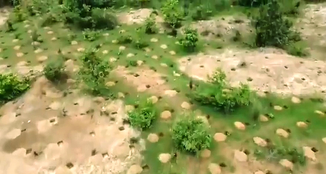
According to a source, before plantation, pictures of places earmarked for the purpose are taken with the help of GPS. These pictures are immediately uploaded on OFMS portal of the Forest department.
Similarly, pictures of different stages of plantation like digging up holes, planting of saplings and filling up the holes are taken and subsequently uploaded.
At places, drones are also being used to take photos. A common man can get all information about the government’s programmes by simply visiting the ‘Mo Jungle’ app. They can write their opinions also.
In the past, there were cases of money being siphoned off from the funds allocated for plantation. The department feels that by using GPS, such malpractices can be eradicated.
In fact, the government had introduced this system last year itself. Then the photographs of the places identified for plantation were taken and uploaded.
However, this year the various stages of plantation will be recorded. This year around 14,00,000 and 11,00,000 saplings will be planted in North Ghumusar forest division and South Ghumusar forest division respectively.
As many as 1,600 saplings per acre will be planted. When asked, Ghumusar DFO Abhay Kant Dalei said all the steps have been taken to ensure success of the programme.
PNN


