
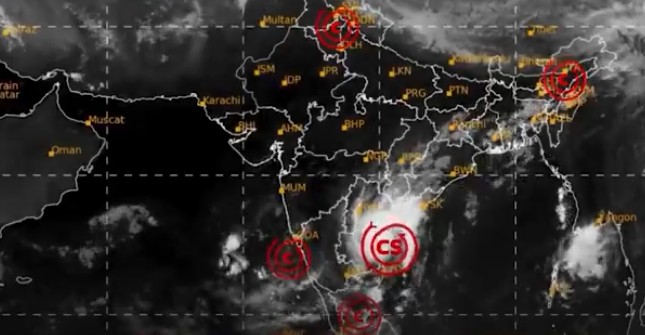
Bhubaneswar: Severe Cyclonic Storm Murasu, which was centred over south coastal Andhra Pradesh Tuesday morning, is likely to weaken into a cyclonic storm by noon and further into a deep depression by midnight, the India Meteorological Department (IMD) said.
In its latest bulletin, the IMD said the system moved north-northwestwards at a speed of 8 kmph during the previous six hours and lay centred near latitude 15.7°N and longitude 80.2°E.
Meanwhile, the IMD has forecast heavy rainfall at isolated places in Koraput and Malkangiri districts of Odisha till 8:30 a.m. Wednesday. Thunderstorms accompanied by lightning and gusty surface winds of 40-50 kmph, gusting to 60 kmph, are also likely at isolated places in the two districts.
Similar weather conditions, with gusty winds of 30-40 kmph reaching 50 kmph, are likely at isolated places in Baleshwar, Bhadrak, Jajpur, Kendrapada, Jagatsinghapur, Kataka, Kendujhar, Mayurbhanj, Rayagada, Gajapati, Ganjam, Puri, Khordha and Nayagada districts.
For the subsequent 24 hours, from 8:30 a.m. Wednesday to 8:30 a.m. Thursday, thunderstorms accompanied by lightning and gusty winds of 30-40 kmph are likely at isolated places in Baleshwar, Bhadrak, Jajpur, Kendrapada, Jagatsinghapur, Kataka, Kendujhar, Mayurbhanj, Nawarangpur, Rayagada, Koraput, Malkangiri, Gajapati, Ganjam, Puri, Khordha and Nayagada districts.
PNN