
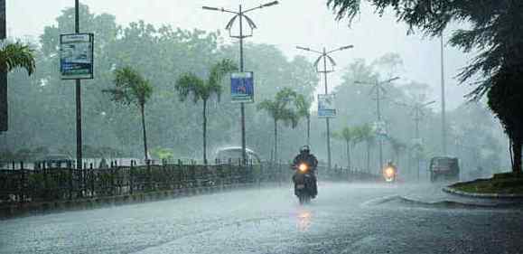
Bhubaneswar: With a depression over Bay of Bengal likely to trigger heavy rain in many parts of Odisha till August 9, the state government Tuesday asked district collectors to be prepared to deal with possible flood.
The Meteorological Centre here said in a special bulletin that the low pressure over Bay of Bengal has intensified into a depression Tuesday.
The depression adjoining coastal Bangladesh and West Bengal lay centered around 160 km southeast of Odisha’s Balasore and about 130 km south-southeast of West Bengal’s Digha, it said.
The low pressure is likely to intensify into a deep depression by Wednesday and will move west-northwestwards across the coastal areas of Odisha and West Bengal till August 10.
It is likely to cause moderate rain or thundershowers at most places in Odisha till August 11 and heavy to very heavy rain in some areas till August 9, the MeT centre said.
In view of the weather forecast, Special Relief Commissioner (SRC) B P Sethi issued an advisory and cautioned that there is likelihood of flood and water logging in different parts of the districts where heavy to very heavy rainfall has been predicted.
The SRC directed concerned District Collectors to keep the administrative machinery prepared to meet any possible situation that may arise in the event of intense rainfall.
The MeT centre has issued “red warning” for districts like Malkangiri, Koraput, Ganjam, Kandhamal, Kalahandi and Puri till Wednesday, predicting heavy to very heavy rain in some areas and extremely heavy rain elsewhere in the six districts.
Heavy to very heavy rain is likely to lash a few places in Gajapati, Boudh, Sonepur, Sambalpur, Deogarh, Cuttack, Dhenkanal and Nayagarh districts, it said.
The MeT Centre has forecast heavy downpour in some areas in Jagatsinghpur, Kendrapada, Jajpur, Bhadrak, Khurda, Angul, Rayagada, Balasore, Mayurbhanj and Keonjhar districts till Wednesday.
Heavy to very heavy rainfall may occur at a few places in Sonepur, Jharsuguda, Angul, Dhenkanal, Kalahandi, Bargarh and Sundargarh districts Wednesday and Thursday, it said.
The weathermen said some areas in Cuttack, Kendrapara, Boudh, Nayagarh, Khurda, Keonjhar, Mayurbhanj and Nabarangpur will receive heavy rain till Thursday.
The Meteorological centre also forecast heavy rain at isolated places in Sundargarh, Bargarh, Keonjhar, Koraput, Nawarangpur and Kalahandi districts on August 8 and 9.
The MeT department has advised fishermen in the coastal areas of Odisha and West Bengal not to venture into the sea till August 10.
It has also advised hoisting of Local Cautionary Signal Number Three (LC-III) at all the ports in Odisha.
The SRC said the areas vulnerable to flood and water logging may be identified in advance and field officials should remain prepared to evacuate people from vulnerable locations to safe shelters.
If required, advance arrangements may be made for providing adequate food, safe drinking water, lighting, health and sanitation facilities at all shelters and relief camps, he said in the advisory.
Fire services teams should remain prepared to carry out search and rescue operation and requirement of ODRAF (Odisha Disaster Rapid Action Force) team, if any, may be intimated.
Arrangements should also be made to restrict people/ vehicles from using roads and bridges under submergence, it added.