
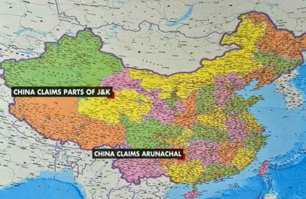
China has included parts of India’s Arunachal Pradesh inside its global boundaries, according to Sky Map’s updated version.
Sky Map, China’s clout on computerized maps, is developed and worked by a unit straightforwardly under Beijing’s National Surveying and Mapping Geographic Information Bureau. As of late, Sky Map clients found that it has refreshed the nation’s guide with the most recent national borders, including India’s Arunachal Pradesh, according to a DW media report.
The north eastern state of India on the fringes of Tibet was actually a British India part in 1913-14. However it was drafted in India following the McMohan Line’s establishment bordering India and Tibet in 1938. As a matter of fact, China continues to count it as their territory after the second largest economy in the world conquered in 1951.
Till date, China’s map is based on Sky Map’s 1989 edition which demarcated its borders. Since then, China has gradually solved its border related matters with Russia and other Central Asian nations, though it wasn’t reflected in its map.
If DW report is anything to go by, some users’ attention was drawn about China’s updation of geographic information at the ‘county’ level. “The county boundaries of some counties clearly transcend the red colour marked 1989 edition of the national border, especially in Tibet area bordering Bhutan and India,” the report was quoted as saying in sections of media.
For the record, China has claimed sovereignty over Tibet counties bordering India and Bhutan from east to west — “Chayu county, Medog county of Linzhi city, Cuona county, Luoza county of Shannan city, Kangma county, Yadong county of Xigaze city,” the report claimed.
Chayu, Medog, and Cuona provinces are partitioned by the McMahon Line with the northern parts in China and the southern parts in India. “Longzi County in Shannan City does not theoretically border India, but the McMahon Line runs through the county from southwest to northeast, with Chinese control in the west and Indian control in the east,” it said.
Meanwhile, Indian portion and part of Chayu county, Motuo county of Nyingchi city and Longzi county and Cuona county of Shannan City, “South Tibet” by the Chinese authorities.
According to the latest Sky Map, “the southern boundary of Chayu county is roughly the same as the boundary in 1989, the southern part of Motuo county has contracted northward, and the southern boundary of Cuona county also roughly coincides with the boundary in 1989. The Longzi county does not border India at all, as Beijing advocates. Cuona county of Shannan city not only borders with India but also borders with Bhutan.”
“China-Bhutan border dispute area, Mulasading, is located in Cuona County-south of the McMahon Line. Mulasading originally belonged to Tibet and was managed by the Tawang Temple. In 1949, India and Bhutan signed the Permanent Peace and Friendship Agreement to transfer Mulasading to Bhutan. In the latest Sky Map, the border of Cuona County in the Mulasading region is south of the 1989 edition of the national border,” it stated.
“In addition to Tibet, the borders of Tashkurgan County in the Kashgar region of Xinjiang have also changed. The northwestern part of the border is more than the 1989 edition. According to the 2011 border agreement between China and Tajikistan, this extra part is 1,158 square kilometers east of the Sarekole Mountains,” according to the report.
China holds the Aksai Chin of India, around 37,000 sq km uninhabited desert at high-altitude of Jammu and Kashmir, which borders China’s Xinjiang province.