
Bhubaneswar/Kolkata: Cyclone ‘Amphan’ gathered strength and intensified Sunday into a severe cyclonic storm over the Bay of Bengal. It is certainly going to trigger heavy rainfall coupled with high-velocity wind in several coastal districts of Odisha and parts of West Bengal, officials said. Cyclone Amphan is likely to cross West Bengal-Bangladesh coasts between Sagar Islands in West Bengal and Hatiya islands in Bangladesh between afternoon and evening of May 20 as a very severe cyclonic storm, Regional MeT Director in Kolkata GK Das said.
Gathering strength
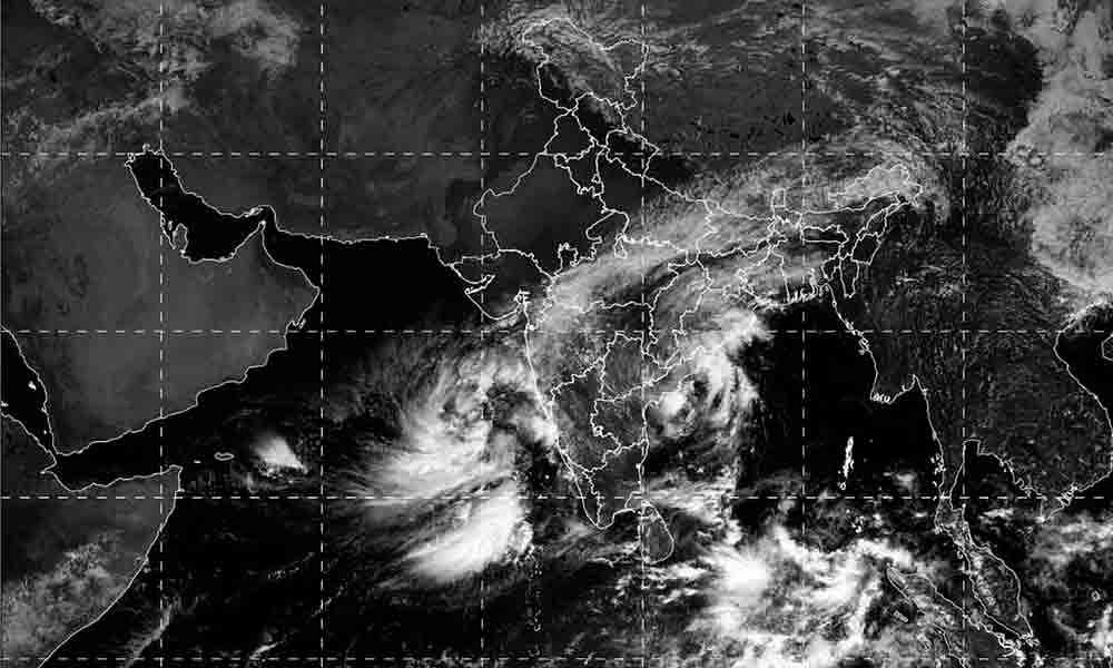
According to a bulletin issued by the weather office at 2 pm, AMPHAN (pronounced as UM-PUN) moved slowly northwestwards with a speed of three kmph and has intensified into a severe cyclonic storm. It lay centred about 980 km south of Paradip in Odisha, 1,130 km south-southwest of Digha in West Bengal and 1,250 km south-southwest of Khepupara in Bangladesh. It is likely to intensify further into a very severe cyclonic storm during the next 12 hours and then move nearly northwards slowly during the next 24 hours.
Movement of ‘Amphan’
Thereafter, it is likely to re-curve north-northeastwards and move fast across northwest Bay of Bengal and cross West Bengal-Bangladesh coasts between Sagar Islands and Hatiya islands between afternoon and evening of May 20, said HR Biswas, Director of the Meteorological Centre in Bhubaneswar.
Under its impact, the coastal districts of Gangetic West Bengal, including North and South 24 Parganas, Kolkata, East and West Midnapore, Howrah and Hooghly are likely to experience light to moderate rain at many places with heavy downpour at isolated places May 19, Das said.
Heavy rainfall expected in coastal Odisha
In Odisha, ‘Amphan’ is likely to trigger heavy rainfall in some parts of Gajapati, Ganjam, Puri, Jagatsinghpur and Kendrapara districts, while moderate rainfall will lash other coastal areas Monday onwards, the MeT Centre said.
Light to moderate rain or thundershower is likely to occur at most places over coastal Odisha, while heavy to very heavy rainfall will lash some places over the coastal areas Tuesday and Wednesday.
Yellow warnings have been issued for the disricts of Koraput, Malkangiri, Nawarangpur, Gajapati, Ganjam, Kandhamal, Mayurbhanj, Balasore, Bhadrak, Puri, Kendrapara, Jajpur and Dhenkanal.
Light to moderate rain or thundershower will occur at many places over north coastal Odisha and some places over the rest of the districts of Odisha May 20 and 21. There will be heavy rainfall at some places over Balasore, Bhadrak, Mayurbhanj and Keonjhar districts on these two days, the IMD said.
Wind speed to increase
Squall with speed reaching 45-55 kmph and gusting to 65 kmph is likely to commence along and off the south Odisha coast from May 18 evening. Wind with similar speed is also likely along and off Odisha coast from May 19 morning. The wind speed will increase becoming gale. Wind speed reaching 75-85 kmph, gusting to 95 kmph from May 20 morning is likely along and off the north Odisha coast.
PNN & Agencies