
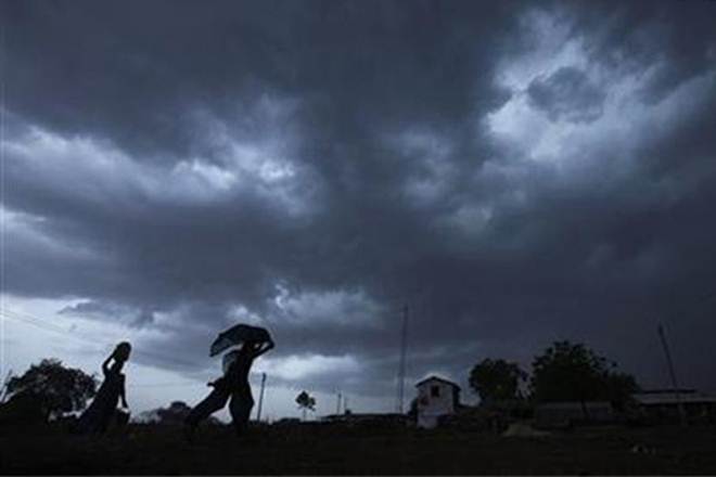
Bhubaneswar: Formation of a low pressure area over the Bay of Bengal is likely to trigger heavy rainfall in Odisha in the next few days, the Meteorological Centre here said Sunday.
Under the influence of a cyclonic circulation over west-central and adjoining northwest Bay of Bengal off north
coastal Andhra Pradesh and south Odisha coasts, a low pressure area has formed over northwest Bay of Bengal off Odisha and Gangetic West Bengal coasts, the MeT Centre said in a bulletin.
The monsoon trough now passes through the centre of the low pressure area over northwest Bay of Bengal off Odisha and Gangetic West Bengal coasts and thence southeastwards to east-central Bay of Bengal, it said.
Moreover, southwest monsoon has been active over Odisha and light to moderate rainfall has occurred at most places in the state with heavy to very heavy rainfall at one or two places over north coastal districts since Saturday.
In view of the prevailing weather conditions, there will be heavy to very heavy rainfall in one or two places over the south coastal, north interior and south Odisha districts at least till July 7, the bulletin said.
There will be light to moderate rain or thundershower at many places in north interior Odisha and Koraput, Malkangiri, Nabarangpur, Rayagada districts and in other parts of the state July 8 and 9, it said.
Heavy to very heavy rainfall is likely to occur in some places in the districts of Nuapada, Balangir, Kalahandi Monday.
Similarly, heavy rainfall is expected in some areas in Sundargarh, Keonjhar and Mayurbhanj districts Tuesday, it said.
As squally weather condition with wind speed reaching 40-50 kmph is likely to prevail over west-central and adjoining north Bay of Bengal off the Odisha coast, fishermen are advised not to venture into the deep sea in these areas during the next 24 hours, the bulletin added.
PTI